
Hawthorne ZIP Code Coverage
Postal coverage in Hawthorne has a broad core and several edge cases. 90250 is the main residential ZIP for east and central portions, but its postal city can extend into nearby unincorporated communities. 90251 is a PO-box-only service, not a residential territory. 90260 brings western and southwestern Hawthorne, including Hollyglen context, into a Lawndale and Hawthorne delivery mix. 90303 and 90045 are boundary interactions, not safe shortcuts for naming a city parcel. USPS does not publish a simple authoritative table of every ZIP that intersects the incorporated Hawthorne polygon, so the rows below distinguish strong coverage from a lead that needs address-level proof.
| ZIP | Areas Covered | Post Office | Notes |
|---|---|---|---|
| 90250 | Most east and central Hawthorne; some nearby unincorporated postal addresses | Hawthorne delivery area | Broad core; postal city can extend beyond the city line |
| 90251 | Hawthorne PO boxes | Hawthorne PO-box service | PO-box-only; not a residential territory |
| 90260 | Western and southwestern Hawthorne, including parts around Hollyglen; Lawndale postal geography | Lawndale and Hawthorne delivery context | Verify each address across the municipal boundary |
| 90303 | Small northern and eastern edge interactions near Hawthorne | Inglewood delivery area | Boundary interaction; verify address by address |
| 90045 | Limited northwest and airport-area postal interaction | Los Angeles and Westchester delivery area | Not a general Hawthorne ZIP; verify the parcel |
A postal label answers where mail is routed. It does not settle whether a parcel lies inside the City of Hawthorne, whether an owner lives there, or whether a household is present today. Keep 90250 as the broad core, treat 90251 as PO-box service, and use 90260 with care where Hollyglen and Lawndale signals overlap. A 90303 or 90045 result needs parcel and municipal verification before it is described as Hawthorne.
Why ZIP 90251 Is Different
90251 belongs in a Hawthorne ZIP directory, but it should not be counted as a residential sweep. Research identifies it as a PO Box ZIP associated with Hawthorne. A box route can connect mail to a post-office box while leaving the holder’s physical parcel, city, and household elsewhere. That distinction matters for genealogy, returned-mail questions, and any attempt to compare postal records with assessor geography.
A 90251 hit confirms a postal service choice. It does not create a situs address. Treat PO-box entries as routing evidence, then use a full street address in USPS when one is known. The Los Angeles County Assessor Portal can tie a known address or AIN to parcel facts, but its public interface does not advertise an owner-name or ZIP-wide resident search. A ZIP code lookup is a delivery clue, not a household finding. A ZIP directory that folds PO boxes into residential counts will overstate geographic coverage.
90260, Hollyglen, and Lawndale
90260 is the clearest local boundary case. Research places western and southwestern Hawthorne, including parts around Hollyglen, in a delivery context that also reaches Lawndale. Hollyglen sits west of I-405 and is a distinct planned area, but a postal label cannot tell whether a specific address is within Hawthorne or a neighboring municipal jurisdiction. A postal directory can narrow the search area. It cannot replace the parcel map.
Start with USPS for the delivery answer. Then compare the same standardized address or AIN in county map resources and city planning or zoning material. Record the exact street, unit, city label, and ZIP returned by USPS. Do not merge a Lawndale postal reference with an incorporated Hawthorne resident record without checking the parcel. The west side’s local identity is why ZIP, postal city, neighborhood name, and municipal line need separate fields.
The USPS ZIP Code Lookup shows the delivery-focused starting point for an address, city, or ZIP search. The ZIP code directory uses that result before checking municipal geography.
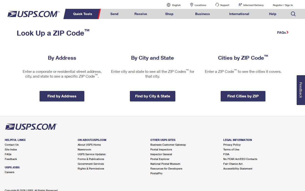
The USPS result validates routing. It does not by itself establish Hawthorne incorporation, parcel ownership, or the identity of people at an address.
Hawthorne ZIP Lines and City Limits
ZIP geography and municipal geography answer different questions. The City of Hawthorne planning and zoning resources help establish land-use and jurisdiction context, while the Los Angeles County Assessor Portal supplies the parcel and AIN link. A postal directory should preserve both results instead of choosing one label and treating it as final. The distinction is especially important near 90260, 90303, and 90045, where postal identity and incorporated identity can diverge.
- ZIP versus ZIP+4
- A five-digit ZIP routes mail through a broad delivery area. ZIP+4 adds four digits for a more precise route or delivery segment; it is not a city boundary or parcel number.
- PO-box ZIP
- A ZIP assigned to post-office boxes can serve a mailing point without describing a residential land area. 90251 is the local example.
- Unique ZIP
- A code reserved for one organization or institution. It should not be read as a general neighborhood or household zone.
- Carrier route
- An operational path used for delivery. A carrier route is narrower than a ZIP but is not a municipal district or public resident list.
Geography check. A postal Hawthorne address can fall outside incorporated Hawthorne, and an incorporated parcel can use a neighboring postal city. Treat the ZIP as one clue.
Find Hawthorne Residents by ZIP
A ZIP-keyed search works best as a sequence of smaller checks. No single Los Angeles County portal publishes a complete, current resident list by ZIP. USPS validates delivery, the Assessor Portal anchors parcels, city maps settle jurisdiction, and voter channels have their own access rules.
- Run the USPS address, city and state, or ZIP search. Save the exact returned city label and ZIP before treating the postal match as settled.
- Use the Assessor Portal Basic Search with a known AIN or standardized address. Note the record’s effective date, situs, legal description, and parcel map context.
- Open Map Search or county GIS resources and compare the parcel with Hawthorne planning and boundary material. A map click can confirm location, not every person at the site.
- Request voter data only through the qualified California voter-file process. ZIP or area filters can be applied after an authorized acquisition, purpose review, fee, and security certification. A CPRA request is not a shortcut around Elections Code limits.
- Use My Voter Status only for the voter’s own authenticated record. It can show status and district details, but it cannot be used to enter a stranger’s name or browse a ZIP.
Once a ZIP narrows the geography to a known street, the Hawthorne by-street records provide the more precise address chain. Keep the postal result, parcel result, and access basis in separate notes.
USPS Fields for ZIP Lookup
The USPS modes are useful because each asks a different question. An address search is the strongest check for one delivery point. A city and state search can reveal postal options without proving a parcel. A cities-by-ZIP search describes labels associated with a code, not every city polygon that code touches.
| Field Label | Type | Required | Format or Use |
|---|---|---|---|
| Street address | Text | Address mode | Use the standardized street number, direction, street name, suffix, and unit when known |
| City | Text | Address mode or city search | Try the returned postal city and compare it with municipal records |
| State | Selection | Address mode or city search | California for Hawthorne-area delivery checks |
| ZIP code | Five-digit text | Cities-by-ZIP mode | Returns postal city labels; it does not return a city-limit map |
| Find or Clear | Button | Interface control | Run the query or remove prior values before a second test |
Use the address mode for a 90260, 90303, or 90045 edge case. Use the city and state mode when a postal label is uncertain. Use cities-by-ZIP to compare labels, then move to AIN and planning records for municipal truth. USPS is the delivery custodian, not the keeper of Hawthorne’s incorporated boundary.
Hawthorne ZIP Records Compared
ZIP-wide resident searches are limited because the strongest local sources are keyed to an address, parcel, or authenticated person. The following comparison keeps the assessor, GIS, and voter roles distinct.
| Source | What ZIP Can Do | Key Limitation |
|---|---|---|
| Assessor Portal | Start from an AIN or address and retrieve current parcel facts | ZIP-wide owner search is not advertised; assessment ownership is not an occupant roster |
| GIS and planning maps | Compare parcel location, city line, land use, and project context | Spatial layers do not name every household, and live buffer or export tools are not promised |
| Qualified voter file | Lawful supplied data may be filtered by area after approval | California Elections Code section 2194 and related regulations restrict purpose, fields, security, and release |
| My Voter Status | One voter can check registration, district, polling, and ballot details | Self-authentication only; it is not a ZIP or block lookup |
The California My Voter Status screen illustrates the boundary: first name, last name, date of birth, and record-dependent identity validation are used to reach one voter’s account.
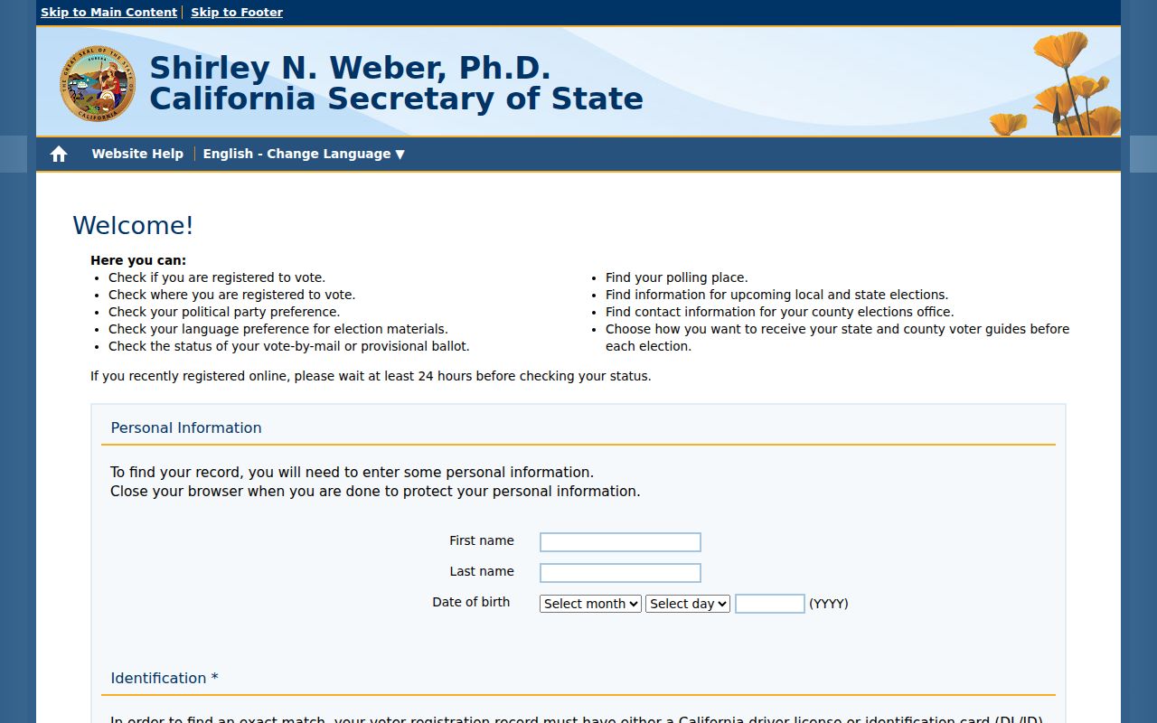
That self-lookup can confirm a person’s own registration status. It cannot turn a ZIP search into a public voter roll, and a qualified file cannot be acquired for an arbitrary personal list.
Hawthorne Numbers and ZCTAs
Census QuickFacts for Hawthorne gives a useful scale check: the 2025 estimate is 82,741 people in 6.09 square miles, compared with 88,083 in the 2020 Census. Those figures describe the incorporated city, not a postal route. They help explain why one ZIP can reach beyond the city line while the city remains compact.
A ZCTA, or ZIP Code Tabulation Area, is a Census statistical approximation built from census geography. It is useful for population context and broad comparisons, but it does not equal a USPS delivery route, an assessor search set, or a list of Hawthorne residents. ZIP code statistics may include different edges than 90250 or 90260. Use them for scale, then return to the exact delivery address and AIN.
Numbers are context. A population estimate can describe Hawthorne without identifying a household or proving that a postal ZIP follows the incorporated boundary.
Verify a Hawthorne ZIP Boundary
When sources disagree, ask the custodian that owns the disputed fact. USPS can correct a delivery question. The Assessor Portal can clarify AIN, situs, legal description, and map context. Hawthorne planning records can address zoning or municipal jurisdiction. None of those offices should be asked to create a citywide resident roster from a ZIP.
For an identifiable planning, permit, or map record, use the Hawthorne City Clerk request channel with the address or parcel, department, date range, and desired record type. California Public Records Act practice generally gives an agency 10 calendar days to determine whether responsive disclosable records exist, with a possible 14-day unusual-circumstances extension. That is a determination window, not a promise that production is complete. Inspection is ordinarily free, while copies may carry direct duplication costs.
A careful ZIP code directory entry therefore keeps four labels visible: the USPS result, the incorporated city, the county custodian, and the source date. That habit resolves the 90250 core, the 90251 PO-box exception, the 90260 Lawndale and Hollyglen overlap, and the 90303 or 90045 boundary interactions without claiming more than the records show.